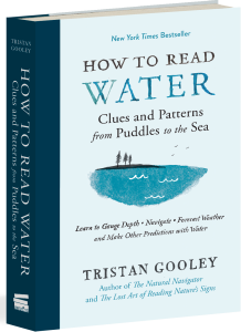
With multiple bestselling books under his belt, it’s no surprise that Tristan Gooley is one of the most knowledgeable nature experts of our time. But even if you aren’t one to scale the mountains of Europe, fly to the Arctic, or sail across the Atlantic, you can still experience nature the way Tristan does. How? Puddles.
That’s right. According to his New York Times bestselling book How to Read Water, learning how to understand the majesty of water is as easy as paying attention to the small, everyday details around you—from puddles, to ocean waves, to the colors in your local pond. In honor of the month of April—the wettest, rainiest, most puddle-friendly month of the year—we’re sharing an excerpt from How to Read Water to help you become a natural tracker in your own neighborhood this spring.
A puddle is evidence: There is quite a lot of water in one particular spot, but none all around it. Why? Puddles are not random. In this chapter we will look at different types of puddles, which all form part of a family tree consisting of the Low Point puddles, the Tracker and the Navigator puddles, the Overhang, Spring, and Seismometer puddles.
Every puddle is a sign that the water has been blocked, stopped from traveling down through the ground. So if a puddle is persistent, then the first thing we can deduce is that the ground beneath the puddle is either not porous or it is saturated. This is mainly interesting when we travel through a rural area and notice that the number of puddles suddenly increases, despite there not being any more rain in that area. This is a sign that the rocks beneath your feet have probably changed, even if the appearance of the mud has not changed. Since the rocks are responsible for a lot of the characteristics of the soil in an area, and the soil strongly influences the types of plants and animals you will find, a sudden change in the number of puddles, without a very local downpour, is a sign that the rocks, soil, plants, and animals all around you will also have changed.
When focusing on a particular area to ask why there are puddles in some specific places but not others, we quickly realize that every puddle is indicating a low point in the local landscape. Water is being pulled down by gravity, so it is always trying to travel downhill until something stops it. For this reason, any local low points of non-porous ground will host puddles.
Roads are designed with a camber so that the water flows from the center to the edge of the road, precisely to avoid puddles in the middle of the road. This water then collects at the edge of the road and should continue to flow gently dowill into a drain. But time has a tendency to warp and buckle the neat plans of road builders, and very often we find that this smooth line from the center of the road, all the way to the drain, gets bumped, bent, and dented by cars, people, and ice, to name a few. Sometimes the place that semitrucks like to stop and unload leads to a depression and a puddle.
Whenever roads are dug up, for repairs or to lay cables, the road is sealed over, but nearly always with a material that is different from the one originally used to build the road. Over time this will swell and contract at a rate different from the rest of the road, and it is very common to find a puddle at the join of the old tarmac to the new. Sometimes the drains themselves cease to work, an urban equivalent of a non-porous rock that stops the water continuing on its downward trajectory, and that will create a puddle, often a very large one.
Urban planners and road builders start with an aim of eliminating puddles altogether, so a puddle anywhere in a town is a sign that something has gone a little bit wrong somewhere, and the simple story behind that can usually be found. From obvious observations, small insights can blossom.
Low point puddles are very common, but not all of them are fascinating. We find a much more interesting branch of the puddle family if we appreciate that the reason one tiny patch of land is lower than the ground around it is because it has been eroded by something. At this point the puddle becomes a clue to activity of some kind, and this means it is part of the Tracker family of puddles. Tracker puddles are a collection that will give you some clue as to those who have been there before you, and what they have been up to.
Whenever anything travels over the land, from a bicycle to a beaver, it will leave tracks, and if these are more common in one place than another, then the ground becomes worn and a small depression may be formed by this erosion. After rain, this depression will collect water. At the most dramatic and obvious end of the scale, water will collect in the ruts and ridges caused by tractors and form a puddle—we’ve all seen thousands of these puddles and stepped to avoid them. But not all puddles have such an obvious history.
Where two paths or tracks cross there will be a patch of ground where the land is worn much more seriously than on either of the two paths, because all the traffic following each path must also cross the junction. This leads to double the erosion in that junction “box,” and so the ground gets worn down and a depression, or more likely a series of depressions, forms at the junction. So, whenever you are on a path that reaches a junction, it’s worth a short pause to look for the Junction puddles, part of the Tracker family, and usually nice and easy to spot.
Now, notice how turning creates more wear and tear on the ground. Turning is something that uses a lot of force, and this force wears away at the ground. At every junction, there will be evidence of the way things have turned. Often there will be curved puddles at junctions: big, glaring ones if vehicles have been turning, slightly subtler ones if cyclists have been turning, and subtler still if walkers have turned, but evidence of each is usually there to be found. Working out the most common direction that people turn is usually fairly easy from the shapes in the mud and the puddles. Whenever a minor path meets a major one, I make a habit of trying to work out the most common direction people turn, as this is the probable direction of a town or village. A Turn puddle is a specific and curved type of Junction puddle, and both are part of the Tracker family.
The concept behind Tracker puddles is simple: The more erosion from somebody or something traveling, the more likely there is to be a puddle in one spot. But just because it is simple does not mean that it cannot be beautiful, and the lighter the footprints, the more joyous it is to spot the puddle they create.

Want to learn even more about the fascinating science and history behind tracking with water? Pick up a copy of Tristan Gooley’s New York Times bestselling book How to Read Water, available now. And, if you simply can’t get enough of Tristan Gooley’s nature expertise, be sure to look out for his next book, The Nature Instinct: Relearning Our Sixth Sense for the Inner Workings of the Natural World, for anyone who wants a comprehensive guide to reading nature’s mind! Available wherever books are sold August 21.


